These are some satellite pictures of mines in Keonjhar and Sundargarh. They are from Google Earth. Quite scary!! But this is the tip of iceberg - the iron ore production from this area is slated to go up ten fold in next few years. These areas are also the home of Paudi Bhuiyans and Juangs, Primitive Tribal Groups of Orissa and come under Schedule V area.
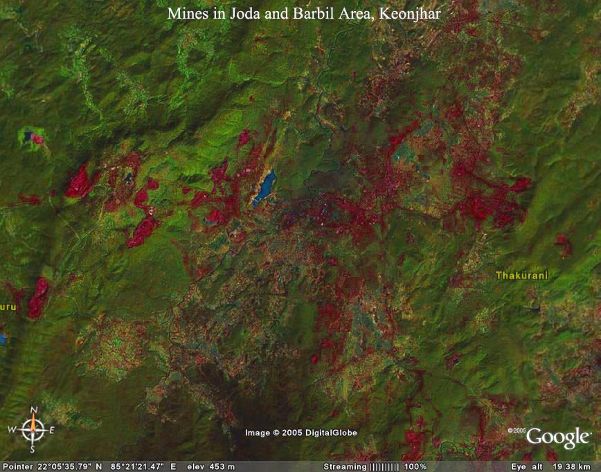 The area covered by the picture is approximately 400 sq. km. This is a true color picture. The blood red patches are the mines. The green patches are mostly forests. The dark patch visible near the bottom seems to be area polluted by sponge iron plants - though we need to confirm that.
This in another satellite picture of a site that is proposed to be leased out to Orissa Sponge Iron Limited for mining. The total area in the map is around 50 sq. km. The dark green patches are forests. The boundary of the mining lease is shown in yellow.There are number of perennial springs on the plateau which form the source of four-five perennial streams, vital sources of water for the local inhabitants. The local people are up in arms against the mining project.
 The Public Hearing for the Project took place Yesterday (31st Oct, 2005) and there was vehemant opposition from the local villagers and activists. As per our information, inspite of heavy police presence, more than a thousand people from nearby areas came all the way to Public hearing site at Kadakala village to protest. Apparently only 23 of these villagers were allowed to speak and submit memorandum. The local activists are planning to protest against this discrimination.
No comments:
Post a Comment